The Cleveland Way Map Booklet : 1:25,000 OS Route Mapping - Paddy Dillon

The Cleveland Way Map Booklet

1:25,000 OS Route Mapping

By: Paddy Dillon

Paperback | 11 July 2018

At a Glance

Paperback


$21.99

or 4 interest-free payments of $5.50 with

Aims to ship in 5 to 10 business days

All the mapping you need to complete the Cleveland Way and Yorkshire Wolds Way national trails plus the Tabular Hills Walk regional trail that links the two routes together. Linking all three trails allows walkers to create a long-distance route of over 400km (250 miles), giving 19 days of easy and enjoyable walking through the North York Moors National Park, taking in open heather moorlands, gentle dales, interesting towns and villages, and dramatic cliff coastlines.

This booklet of Ordnance Survey 1:25,000 Explorer maps has been designed for convenient use on the trail. It shows the full and up-to-date line of each national trail, along with the relevant extract from the OS Explorer map legend, and can be used when walking the route in either direction. It is conveniently sized for slipping into a jacket pocket or the top of a rucksack and comes in a clear PVC sleeve.

More in Travel Maps & Atlases

Brilliant Maps in the Wild - Mike Higgins

RRP $34.99

$33.25

Junior Atlas of Indigenous Australia - Macquarie Dictionary

RRP $39.99

$27.80

30%
OFF
Collins World Wall Laminated Map - Collins Maps

RRP $28.99

$27.25

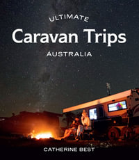
Ultimate Caravan Trips : Australia - Catherine Best

RRP $45.00

$37.25

17%
OFF
Terrible Maps : Hilarious Maps for a Ridiculous World - Terrible Maps
Off the Leash in Australia : Guide to Dog-friendly Travel - Shandos Cleaver
Touring Atlas of Australia 30th Edition - UBD Gregory's

RRP $28.00

$23.80

15%
OFF
Top Walks in New South Wales : 2nd Edition - Ken Eastwood

RRP $36.99

$31.50

15%
OFF
The Travel Atlas : Lonely Planet Travel Guide : 1st Edition - Lonely Planet Travel Guide
Ultimate 4WD Tracks: Australia : Ultimate - Anthony Ham

RRP $45.00

$37.25

17%
OFF
Collins World Atlas : Complete Edition: 4th Edition - Collins Maps
Ultimate Coastal Road Trips : Australia - Lee Atkinson

RRP $45.00

$37.25

17%
OFF
Macquarie Atlas of Indigenous Australia : 2nd Edition - Bill Arthur
Road Atlas of Australia : 6th Edition - UBD Gregory's

RRP $34.99

$29.75

15%
OFF
DK Japan : DK Eyewitness Travel Guides Japan - Dk Eyewitness

RRP $37.99

$33.90

11%
OFF
The Times Comprehensive Atlas of the World [16th Edition] - Times Atlases
Europe Planning Map : Lonely Planet Country Map - Lonely Planet
New Zealand Planning Map : Lonely Planet Country Map - Lonely Planet
Italy Planning Map : Lonely Planet Country Map - Lonely Planet
USA Planning Map : Lonely Planet Country Map - Lonely Planet