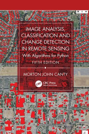
Image Analysis, Classification and Change Detection in Remote Sensing : With Algorithms for Python - Morton John Canty

eTEXT

Image Analysis, Classification and Change Detection in Remote Sensing

With Algorithms for Python

By: Morton John Canty

eText | 3 June 2025 | Edition Number 5

At a Glance

eText


$94.59

or 4 interest-free payments of $23.65 with

 or 

Available: 3rd June 2025

Preorder. Online access available after release.

Read online on
Desktop
Tablet
Mobile

Not downloadable to your eReader or an app

Why choose an eTextbook?

Instant Access *

Purchase and read your book immediately

Read Aloud

Listen and follow along as Bookshelf reads to you

Study Tools

Built-in study tools like highlights and more

* eTextbooks are not downloadable to your eReader or an app and can be accessed via web browsers only. You must be connected to the internet and have no technical issues with your device or browser that could prevent the eTextbook from operating.

The fifth edition of this core textbook in advanced remote sensing continues to maintain its emphasis on statistically motivated, data-driven techniques for remote sensing image analysis. The theoretical substance remains essentially the same, with new material on convolutional neural networks, transfer learning, image segmentation, random forests, and an extended implementation of sequential change detection with radar satellites. The tools which apply the algorithms to real remote sensing data are brought thoroughly up to date. As these software tools have evolved substantially with time, the fifth edition replaces the now obsolete Python 2 with Python 3 and takes advantage of the high-level packages that are based on it, such as Colab, TensorFlow/KERAS, Scikit-Learn, and the Google Earth Engine Python API.

New in the Fifth Edition:

  • Thoroughly revised to include the updates needed in all chapters because of the necessary changes to the software.
  • Replaces Python 2 with Python 3 tools and updates all associated subroutines, Jupyter notebooks and Python scripts.
  • Presents easy, platform-independent software installation methods with Docker containers.
  • Each chapter concludes with exercises complementing or extending the material in the text.
  • Utilizes freely accessible imagery via the Google Earth Engine and provides many examples of cloud programming (Google Earth Engine API).
  • Examines deep learning examples including TensorFlow and a sound introduction to neural networks.

This new text is essential for all upper-level undergraduate and graduate students pursuing degrees in Geography, Geology, Geophysics, Environmental Sciences and Engineering, Urban Planning, and the many subdisciplines that include advanced courses in remote sensing. It is also a great resource for researchers and scientists interested in learning techniques and technologies for collecting, analyzing, managing, processing, and visualizing geospatial datasets.

Read online on
Desktop
Tablet
Mobile

More in Geography

Living on the Edge - Yvonne Claypole

eBOOK

A Life of Extremes - Jeff McMullen

eBOOK

Hubert Who? - Malcolm Andrews

eBOOK

$12.99

Welcome to the Outback - Sue Williams

eBOOK

High and Dry - Guy Pearse

eBOOK

$15.99

Captain James Cook - Rob Mundle

eBOOK

Letters from Everest - George Lowe

eBOOK